By Collin Eaton (NYSE:ETN)
NEW ORLEANS (Reuters) - Storm Barry trudged through northwestern Louisiana on Sunday, weakening to a tropical depression but dropping up to 15 inches (38 cm) of rain in some places to create life-threatening flood conditions along the Mississippi River.
Barry, which made landfall on Saturday as a Category 1 hurricane on the five-step Saffir-Simpson scale of intensity and then quickly weakened to a tropical storm, was 20 miles (35 km) north-northeast of Shreveport with maximum sustained winds of 35 miles per hour (55 kph) by early Sunday evening.
Fears that Barry might devastate the low-lying city of New Orleans like Hurricane Katrina did in 2005 were unfounded, but rain in the forecast could still cause dangerous flooding into Monday, meteorologists said.
The National Hurricane Center said 3 to 5 inches (7.6-12.7 cm) of more rain was expected across south-central Louisiana, with isolated storm totals of 10 to 15 inches (25-38 cm) in some areas.
"This additional rainfall will lead to dangerous, life-threatening flooding," the NHC said in a bulletin.
The National Weather Service warned that tornadoes were possible across portions of southeastern Louisiana, Mississippi, western Alabama, eastern Arkansas and western Tennessee.
New Orleans saw light rain on Sunday, and churches and several businesses were open, including some on Tchoupitoulas Street along the flooded Mississippi River. Streets in the city's popular garden district were quieter than usual but some joggers and dogwalkers ventured out.
A concert by the Rolling Stones scheduled for Sunday at the Mercedes-Benz Superdome, which served as an emergency shelter during Katrina, was postponed until Monday because of the weather forecast, the venue said on its website.
The New Orleans Police Department tweeted on Sunday: "HELLO @RollingStones — the @CityOfNOLA is ready to roll with you tomorrow! Thanks again for sticking around an extra day — we appreciate ya!"
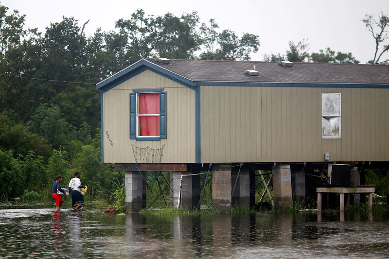
Sixty-five miles (105 km) southeast of New Orleans in Plaquemines Parish, part of which lies below sea level, residents received mandatory evacuation orders ahead of Barry's impact.
Emmett Sylve, 74, said the storm had destroyed his trailer home after 4 feet (1.2 m)of water poured in "like Niagara Falls."
Sylve's cousin Elliott, 75, said he hoped the Federal Emergency Management Agency would help provide new housing for Emmett.
"We're all elderly people here, this is our property and we don't have anywhere to go," Elliot said. "We don't have the resources to stay in a motel for seven or eight days."
In New Orleans, the Mississippi River crested late on Friday at just under 17 feet (5.2 m), according to authorities, much lower than a prediction earlier in the week of 20 feet (6.1 m), near the height of the city's levees.

Barry has shut in 73%, or 1.38 million barrels per day (bpd), of crude oil production in the U.S.-regulated areas of the Gulf of Mexico, officials said on Sunday.